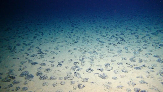
Oceanic basin
Ocean basins are vast, interconnected depressions holding most of Earth's seawater.

An oceanic basin is any area of the Earth covered by seawater, most commonly divided into basins following continental distribution: North and South Atlantic, North and South Pacific, Indian Ocean, Arctic Ocean, and the Southern Ocean. Geologically, most ocean basins are large geologic basins below sea level, covering 67% of the Earth's surface and containing nearly 97% of all water on the planet, with an average depth of almost 4 km.
- surface_coverage
- 67% of Earth's surface
- water_content
- nearly 97% of all water on Earth
- average_depth
- almost 4 km (about 2.5 miles)
- oldest_crust_age
- around 200 million years
Lore & Background
Ocean basins have changed over geological time. About 200 million years ago, the supercontinent Pangea began splitting, causing some basins to shrink (e.g., Pacific) and others to form (e.g., Atlantic and Arctic). The Atlantic Basin began forming around 180 million years ago as Laurasia drifted from Africa and South America. Later, the Norwegian Sea and Eurasian Basin in the Arctic formed about 60 million years ago as Greenland and Europe separated.
Reader's Guide
Oceanic basins are fundamental to Earth's geography and hydrology, covering two-thirds of the planet's surface and holding the vast majority of its water. Their definition has evolved: traditionally based on continental boundaries for navigational convenience, more recent approaches use surface connectivity models to define basins as regions where surface particles (e.g., plastic, biomass) tend to remain trapped, as demonstrated by Froyland et al. (2014). Geologically, ocean basins are dynamic features shaped by plate tectonics—they are sites of crust creation at mid-ocean ridges and destruction at subduction zones. The relatively young age of oceanic crust (maximum ~200 million years) contrasts with Earth's 4.6-billion-year age, indicating continuous recycling. The basins serve as repositories for sediments eroded from continents and for biological remains, though modern views emphasize their basaltic plains nature. Understanding ocean basins is crucial for climate science, marine ecology, and resource management, as their boundaries influence ocean circulation, garbage patch formation, and tectonic activity.
Did You Know?
- All ocean basins collectively cover 67% of Earth's surface and contain nearly 97% of all water on the planet.
- The oldest oceanic crust is only about 200 million years old, far younger than Earth's 4.6-billion-year age.
Scale and Global Dominance
The oceanic basins represent the dominant feature of our planet's surface, collectively spanning 67 percent of Earth's total area and holding nearly 97 percent of all water found anywhere on the globe. These vast underwater regions sit at an average depth of roughly four kilometers, or about two and a half miles, placing them far below the reach of everyday human activity. Despite their staggering combined volume, these basins are not isolated bodies of water; they remain interconnected, a fact that many oceanographers emphasize when they prefer to speak of a single, unified ocean rather than a collection of separate basins.
Boundaries and the Question of Division
The way we draw lines across the ocean to separate one basin from another is largely a matter of practical convenience rather than any natural geographic or physical reality. The foundational document, Limits of Oceans and Seas, was published by the International Hydrographic Office in 1953 and established the basin divisions still widely used today. These boundaries were originally set to aid in compiling sailing directions and carry no political weight. For example, the dividing line between the North and South Atlantic simply follows the equator. The major basins are further subdivided into smaller named regions such as the Baltic Sea, the North Sea, the Greenland Sea, the Norwegian Sea, the Laptev Sea, the Gulf of Mexico, and the South China Sea. Yet because all ocean basins are physically interconnected, a significant number of oceanographers continue to advocate for treating the entire global ocean as one single basin rather than accepting the artificial partitioning into multiple named regions.
Tectonic Formation and Earth's Layered Structure
Oceanic basins are not static depressions but the products of dynamic geological processes rooted in Earth's layered structure. The planet can be divided into three major components based on chemical composition and physical state: the mantle, the core, and the crust. The crust, the outermost solid-rock layer, exists in two distinct forms. Beneath sea level it appears as oceanic crust, which is thinner and composed of relatively dense basalt. On land it takes the form of continental crust, which is less dense and dominated by granite. Together with the uppermost portion of the mantle, the crust forms the lithosphere, which is fractured into sections known as tectonic plates. These plates drift at a pace of only five to ten centimeters per year, yet their interactions along boundaries drive most of the planet's seismic and volcanic activity. At convergent boundaries, the denser plate subducts beneath the lighter one, producing oceanic trenches or mountain ranges. At divergent boundaries, plates pull apart and magma rises to fill the gap, building mid-ocean ridges. Transform boundaries involve purely horizontal sliding, creating faults predominantly within the oceanic crust.
From Sediment Traps to Surface-Connectivity Models
Historically, oceanic basins were viewed primarily as sedimentary repositories. These basins also collected the remains of carbonate- and silica-secreting organisms including coral reefs, diatoms, radiolarians, and foraminifera. In a different vein, Froyland and colleagues in 2014 proposed defining basins through surface connectivity rather than depth or width. Using a Markov Chain model built from short-term trajectory data of surface particles in a global ocean model, they calculated the probability of a particle moving from one grid point to another. The resulting eigenvectors revealed regions of attraction where surface materials like plastic, biomass, and water tend to become trapped, with the Atlantic garbage patch serving as one prominent example. This approach preserves the five main basins but redraws their boundaries along lines of minimal surface connectivity.
Frequently Asked Questions
What exactly is an Oceanic basin?
An oceanic basin is a massive depression in Earth's crust that sits below sea level and is filled with seawater. Think of it as the planet's primary water-holding structure, stretched across the globe in several interconnected regions.
How much of Earth do Oceanic basins cover?
They blanket roughly 67% of the planet's surface, making them the dominant feature you'd see from space. In terms of water storage, they hold close to 97% of every drop of water on Earth.
How deep do Oceanic basins typically go?
The average depth across all ocean basins is just under 4 kilometers, or about 2.5 miles. That means if you dropped a plumb line from the surface, you'd hit the seafloor at roughly that distance on average.
How old is the oldest crust in an Oceanic basin?
The oldest oceanic crust dates back to roughly 200 million years, which is far younger than continental crust. This is because oceanic plates are constantly recycled at subduction zones, preventing any basin floor from growing much older.
Why do geologists and fans care so much about Oceanic basins?
They form the structural backbone of marine geology, governing everything from plate tectonics to global climate regulation. Without these vast basins, Earth's water cycle, ocean currents, and the distribution of marine life would be unrecognizable.
More in Coastal & Marine Geology 1-21
Spotted an error? Know more?
This is a living reference — every entry is fact-audited, and reader corrections feed straight into our audit queue. Suggest an edit · See this site's audit record